|
CaptNemo Geocaching 
Links and information about the worlds biggest treasure hunt! Maping tools/sites, How gps works, Software |
|
CaptNemo Geocaching 
Links and information about the worlds biggest treasure hunt! Maping tools/sites, How gps works, Software |
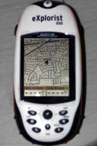
Update- 12/23/05- Another reversal on my opinion of the explorist 400.
I'm still not happy with Magellan as they never helped to resolve the problem I had with my explorist 400 but I was able to return in to the retailer and get another one. The second one is performing very well. None of the slow start up problems etc that I had experienced with the previous unit, leading me to believe that the problem was a defective unit all along. So while I might recommend the explorist 400 as a gps reciever with a lot of great features I can't really recomend buying anything from magellan.
10/26/05- I've now completely reversed my opinion of the explorist 400. I was initially very happy with it's features but as I used it more I experienced more and more problems- frequent lock ups, long delays (10minutes or more) while it 'searched' for satelites even under a clear open sky. The list goes on till one day it just quit working entirely. It starts up and says 'press enter to load NAND or esc to cancel', either response generates a blank screen. I held off saying anything about this here till I had a chance to try and contact magellan. Two weeks ago I e-mailed their support but never recieved more then the automated reply. I've tried several phone calls but merely get transferred to a 'technician' only to get a recording stating that an appropriate technician is not available please call back. I'm appalled at this poor level of service on an item that I consider pretty high priced. I have to say to anyone considering the purchase of an explorist 400 or any of the explorist gps recievers to reconsider.
9/27/05 I had the misfortune to lose my explorist 100, but have now had a replacement for a little over a month and I have to the say the explorist 400 is a fantastic replacement.
At first it had very little functionality beyond what I had with the explorist 100, but I quickly figured out how to connect the usb cable and download geocaches to the gps. No more typing them in, yeah! Later I obtained the mapsend maps and a 512mb SD card. Now I have access to detailed street maps, turn by turn driving directions and a database of nearby resturants, atms,airports and all sorts of other things. This thing continues to amaze me.
Now that said there are a couple of things I don't like. First of all I haven't found a way to stop it from searching for satelites, which means if you try viewing the maps or anything inside where there isn't any reception, it tends to lock up until you get it back outside and retart the gps. Secondly I've noticed that after having it on all day and doing a lot of street routes it starts going really slow- clearing the memory of recent routes and track logs seems to solve this though.
If you're looking for an inexpensive car adapter for your explorist 400, I found a belkin usb power adapter for my palm m130 for $19 at office depot and when I'm not charging my palm pilot I can plug in the explorist. This works great for driving around town as it doesn't drain the explorist battery so I can even have the backlight on high for better visibility. (normally I would leave this off as it drains the battery pretty quick)
Well I have another hobby! and yes it's geocaching (in case you hadn't guessed yet) We can blame all this on Eileen aka IMCAVER who asked me a few weeks ago if I wanted to go along while she hunted some caches.
Now just what is geocaching? Well to answer that you may just want to head on over to geocaching.com and see what they have to say. In short though it's the modern day equivalent of a scavenger hunt. People stash containers with items and/or a log book and then post the latitude and longitude co-ordinates somewhere so others can go try to find them. To do this you need expert map reading skills or a gps unit. Of course both couldn't hurt.
The Global Positioning System (GPS) is a worldwide radio-navigation system formed from a constellation of 24 satellites and their ground stations.
These days GPS is finding its way into cars, boats, planes, construction equipment, laptop computers and almost everything else imaginable. Soon GPS will become almost as basic as the telephone.
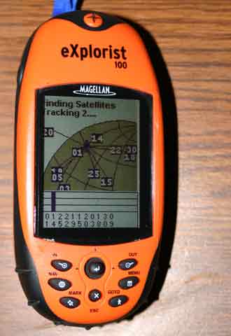
Following this is an explaination of how gps works but to go geocaching all you need to know is that you enter the co-ordinates you need to reach and it tells you the direction and distance to that point. To get started geocaching, you should have a GPS receiver. It's not a requirement, but it does make the search significantly easier. There are several different types of GPS devices you can purchase, depending on your needs and your price range. There are two main brands of hand helds being used, garmin and magellan I went with an explorist 100 from magellan
 for the simple reason it was on sale for less then $60.
So far I've been very happy with it and it has led me right up to most caches.
I'll probably want a unit I can connect to my pc later but for now this will do.
Next You'll need some co-ordinates to enter in your new gps. You can head over to my links section of this page to check out geocaching pages where you can find listings of where caches are located.
|
|
|
|
|
|
 if you want to see what caches I've visited recently.
|
Ok, if you want to go geocaching without printing up all those co-ordinates and cache descriptions you need a way to download them and take them with you. The best solution I have found is a program called cachemate which installs on my palm pilot and lets me store loads of cache descriptions. It even searches throught the ones I've downloaded to tell me which one is nearest to my present position! Here are the steps to get going on your quest for paperless caching(using a palm pilot) :
|
